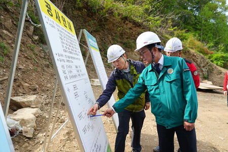
▲ 충남 계룡시 '2025년 농소1지구 지적재조사사업' 현장사무소 운영 모습 © 계룡시 제공 |
충남 계룡시가 농소1지구 지적재조사사업 추진에 박차를 가하고 있다.
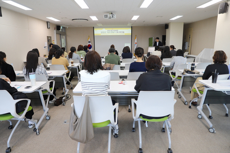
시는 지난 11일, 농소리 경로당에 현장사무소를 설치하고 해당 지역 토지소유자 및 이해관계인을 대상으로 대면 상담을 실시했다. 이번 현장 운영은 충청남도 지적재조사 현장상담실과 공동으로 운영돼, 지적 경계 협의를 포함한 다양한 상담서비스가 제공됐다.
이번 행사는 단순한 행정 절차를 넘어서 주민과의 직접 소통을 강조했다. 현장에는 과거와 현재의 지적도를 나란히 비교할 수 있는 지적 자료와 토지대장이 전시됐고, 변화된 측량 장비들도 함께 소개됐다. 이를 통해 지적제도의 역사적 변천사를 쉽게 이해할 수 있도록 돕고, 주민들이 지적재조사사업의 필요성과 진행 방식에 대한 이해를 높이도록 유도했다.
지적재조사사업은 토지 경계의 정확한 확정과 토지 정보의 디지털화를 통해 주민의 재산권을 보호하고, 토지 이용의 효율성을 제고하는 것을 목적으로 한다.
시는 현장사무소를 오는 20일까지 운영하여 주민들의 의견을 적극 수렴한다는 방침이며, 현재 농소1지구 내 토지소유자들의 동의를 순차적으로 받아 지구 지정을 완료한 뒤, 경계 협의를 거쳐 2026년까지 사업을 마무리할 계획이다.
시 관계자는 “지적재조사사업은 지역 주민의 권리를 보호하고, 토지의 효율적인 관리를 위한 필수적인 기반사업”이라며, “현장 상담 기간 동안 보다 많은 토지소유자와 이해관계인의 관심과 참여를 기대한다”고 밝혔다.
*아래는 위 기사를 '구글 번역'으로 번역한 영문 기사의 [전문]입니다. '구글번역'은 이해도를 높이기를 위해 노력하고 있습니다. 영문 번역에 오류가 있을 수 있음을 전제로 합니다.<*The following is [the full text] of the English article translated by 'Google Translate'. 'Google Translate' is working hard to improve understanding. It is assumed that there may be errors in the English translation.>
Gyeryong City, South Chungcheong Province, is accelerating the implementation of the land readjustment project in Nongso District 1.
On the 11th, the city established a field office at the Nongso-ri Senior Center and conducted face-to-face consultations for landowners and stakeholders in the area. This field operation was jointly operated with the Chungcheongnam-do Land Readjustment Field Consultation Office, and various consultation services including land boundary consultation were provided.
This event emphasized direct communication with residents beyond simple administrative procedures. Land registers and land data that allowed comparison of past and present land maps were displayed at the site, and changed surveying equipment was also introduced. Through this, it was possible to easily understand the historical changes in the land system and to encourage residents to understand the necessity and progress of the land readjustment project.
The land readjustment project aims to protect residents’ property rights and improve the efficiency of land use through accurate determination of land boundaries and digitalization of land information.
The city plans to operate the field office until the 20th to actively collect opinions from residents, and plans to sequentially receive consent from landowners in the current Nongso 1st District, complete the district designation, and then complete the project by 2026 after boundary consultation.
A city official said, “The land survey project is an essential foundation project to protect the rights of local residents and efficiently manage land,” and “We expect more interest and participation from landowners and stakeholders during the field consultation period.”
원본 기사 보기:브레이크뉴스대전세종충청