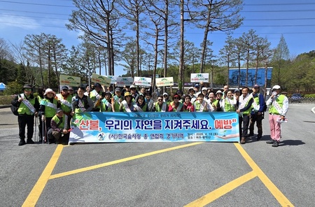
▲ 김해시 경계결정위원회 개최 |
[브레이크뉴스=양영석 기자] 김해시가 경계결정위원회를 개최해 5개 지구 828필지에 대해 토지경계와 면적을 확정했다고 6일 밝혔다.
이번 지적재조사사업은 진례 산월, 진례 관곡, 한림 시호, 대동 신동, 율하1지구 5개 지구로, 시는 총 1억7,000여 만원을 투입해 828필지(28만3,932㎡)에 대해 지적재조사 측량 결과와 토지현황, 토지소유자 간 경계 협의 내용을 종합적으로 검토해 토지경계와 면적을 확정했다.
경계결정위원회의 의결 결과는 토지소유자, 이해관계인에게 개별 통지될 예정이며, 통지를 받은 날부터 60일 이내 이의신청이 가능하다.
이의신청이 없을 경우 해당 경계는 확정되며, 이후 새로운 지적공부 작성과 등기촉탁 등 후속 절차가 진행된다.
시는 경계 확정 이후 면적 증감이 발생한 토지는 감정평가를 통해 조정금을 징수·지급할 계획이다.
사업이 완료되면 정확한 토지경계를 제공·관리함으로써 건축물 저촉 해소, 맹지 해소, 토지 정형화 등 토지 이용 여건이 개선되고, 이에 따른 경제적 효과도 기대된다.
한편, 김해시는 지적재조사사업 대상 1만 9,000여 필지 중 이번 사업지구를 포함해 약 40%에 해당하는 54개지구 7,800여 필지를 정리했으며 올해는 6개 지구 1,023여 필지를 대상으로 사업을 진행 중이다.
*아래는 위 기사를 '구글 번역'으로 번역한 영문 기사의 [전문]입니다. '구글번역'은 이해도 높이기를 위해 노력하고 있습니다. 영문 번역에 오류가 있을 수 있음을 전제로 합니다.<*The following is [the full text] of the English article translated by 'Google Translate'. 'Google Translate' is working hard to improve understanding. It is assumed that there may be errors in the English translation.>
Gimhae City Confirms New Boundaries for 828 Parcels in 5 Districts
Cadastral Resurvey to be Completed in 2025
Gimhae City announced on the 6th that it held a Boundary Determination Committee meeting and confirmed the land boundaries and areas for 828 parcels across five districts.
This cadastral resurvey project covered five districts: Jinrye Sanwol, Jinrye Gwangok, Hanlim Siho, Daedong Sindong, and Yulha District 1. The city invested a total of approximately 170 million won to comprehensively review the results of the cadastral resurvey survey, current land conditions, and boundary agreements between landowners regarding the 828 parcels (283,932㎡) to finalize the boundaries and areas.
The results of the Boundary Determination Committee's decision will be individually notified to landowners and interested parties, and objections may be filed within 60 days of receiving the notification.
If no objections are filed, the relevant boundaries will be finalized, and subsequent procedures, such as the creation of new cadastral records and requests for registration, will proceed. The city plans to collect and pay adjustment fees through appraisals for land parcels that have experienced increases or decreases in area following the boundary determination.
Once the project is completed, providing and managing accurate land boundaries will improve land use conditions by resolving building encroachments, eliminating landlocked parcels, and regularizing land parcels; consequent economic benefits are also expected.
Meanwhile, Gimhae City has organized approximately 7,800 parcels across 54 districts—accounting for about 40% of the 19,000 parcels subject to the cadastral resurvey project, including the current project area—and is currently proceeding with the project this year targeting approximately 1,023 parcels across 6 districts.
원본 기사 보기:브레이크뉴스경남