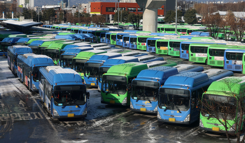
▲ 네이버 지도, 대중교통 관련 안전 정보 실시간 제공 업데이트 ©브레이크뉴스 |
브레이크뉴스 최애리 기자= 네이버가 대중교통 이용자의 이동 편의성과 안전성을 높이기 위해 지도 서비스 기능을 강화한다.
네이버는 13일 대중교통 길찾기 이용 시 사고나 운행 중단, 무정차 등 다양한 교통 안전 정보를 실시간으로 확인할 수 있도록 네이버 지도 업데이트를 실시한다고 밝혔다.
이번 업데이트를 통해 이용자들은 대중교통 이동에 영향을 미치는 사고, 연착 등 유고 정보를 길찾기와 지도 메인 화면에서 실시간으로 확인할 수 있게 된다. 이에 따라 이동 중에도 변화하는 운행 상황을 빠르게 파악하고 보다 효율적인 이동 계획을 세울 수 있을 것으로 기대된다.
특히 유고가 발생한 지하철역, 버스 정류장, 기차역 등의 위치를 지도에서 바로 확인할 수 있어 대체 경로를 찾거나 이동 계획을 조정하는 데 도움이 된다. 네이버는 향후 이러한 유고 정보 제공 대상을 다른 교통수단으로도 확대할 계획이다.
네이버 지도는 앞서 2024년에도 사용자 생활권 내 발생하는 사고나 재해 정보를 보다 상세히 제공하고 내비게이션 이용 시 재난 정보를 강화하는 업데이트를 진행한 바 있다. 이번 기능 개선 역시 사용자 이동 지원 서비스를 고도화하는 연장선으로, 생활 밀착형 정보를 통해 이동 편의성과 안전성을 높이기 위한 조치라는 설명이다.
네이버 관계자는 “네이버 지도는 월간 활성 이용자(MAU) 약 3천만 명이 이용하는 국내 최대 지도 서비스로, 사용자들이 보다 안전하고 효율적으로 이동할 수 있도록 지원하는 것을 목표로 하고 있다”며 “앞으로도 더욱 정교하고 편리한 이동 경험을 제공하기 위해 서비스를 지속적으로 고도화해 나가겠다”고 말했다.
*아래는 위 기사를 '구글 번역'으로 번역한 영문 기사의 [전문]입니다. '구글번역'은 이해도 높이기를 위해 노력하고 있습니다. 영문 번역에 오류가 있을 수 있음을 전제로 합니다.<*The following is [the full text] of the English article translated by 'Google Translate'. 'Google Translate' is working hard to improve understanding. It is assumed that there may be errors in the English translation.>
Naver Maps Updates to Provide Real-Time Public Transportation Safety Information
Naver is enhancing its map service features to improve the mobility and safety of public transportation users.
On the 13th, Naver announced that it is implementing an update to Naver Maps that allows users to check various traffic safety information in real time, such as accidents, service suspensions, and non-stop services, when using public transportation route finding.
Through this update, users will be able to check real-time information on incidents affecting public transportation travel, such as accidents and delays, right on the route finding and main map screens. As a result, it is expected that users will be able to quickly grasp changing operational conditions even while on the move and formulate more efficient travel plans.
In particular, users can immediately check the locations of subway stations, bus stops, and train stations where incidents have occurred on the map, which helps them find alternative routes or adjust travel plans. Naver plans to expand the scope of this incident information provision to other modes of transportation in the future.
Naver Maps previously conducted an update in 2024 to provide more detailed information on accidents and disasters occurring within users' living areas and to strengthen disaster information when using the navigation function. This latest feature improvement is also an extension of the advancement of user mobility support services, and is explained as a measure to enhance mobility convenience and safety through lifestyle-oriented information.
A Naver official stated, “Naver Maps is the largest map service in Korea, used by approximately 30 million monthly active users (MAU), and our goal is to support users in moving more safely and efficiently,” adding, “We will continue to advance our services to provide an even more sophisticated and convenient mobility experience.”