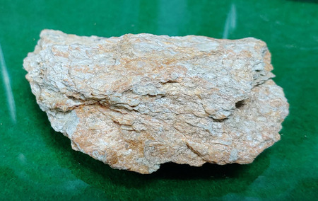
▲ 내이3지구 드론 3D 정사영상 |
[브레이크뉴스=황민성 기자] 밀양시가 드론을 활용한 스마트 토지행정 서비스 구축에 속도를 내고 있다.
시는 드론 기술을 단순한 영상 촬영을 넘어 지적확정측량 검사 개별공시지가 토지특성조사 개발부담금 대상지 현장 확인 등 고도의 정밀성이 요구되는 지적 업무 전반에 본격 투입해 업무 효율성을 획기적으로 개선하고 있다고 27일 밝혔다.
핵심은 대규모 개발사업 완료 후 실시하는 지적확정측량 과정에서의 드론 활용이다.
시는 정밀도가 3cm 이내인 고정밀 RTK 기능이 탑재된 드론을 활용해 상공에서 사업지 전체의 경계와 시설물 배치 상태를 한눈에 확인한다.
이를 통해 실제 공사 현황과 확정측량 성과를 실시간으로 확인함으로써 지적공부의 정확도를 높이고 향후 발생할 수 있는 경계 분쟁을 사전에 차단하고 있다.
또한, 접근이 어려운 산간 지역의 토지특성조사에도 드론의 위력이 발휘되고 있다.
그간 담당 공무원이 직접 현장을 확인하는 데 한계가 있었으나, 드론으로 촬영한 정사영상과 3D 영상을 지적도와 중첩해 모니터링함으로써, 현장 방문 없이도 정확한 토지 특성 파악이 가능해졌다.
밀양시는 전문성 강화와 예산 절감을 위해 공무원이 직접 드론 조종 자격증을 취득해 현장 업무를 수행하고 있다.
현장 전문 지식을 갖춘 담당자가 직접 드론을 조종하고 데이터를 분석함으로써 행정의 신뢰도를 높이고 외부 용역 의존도를 낮추어 예산 절감 효과까지 거두고 있다.
*아래는 위 기사를 '구글 번역'으로 번역한 영문 기사의 [전문]입니다. '구글번역'은 이해도 높이기를 위해 노력하고 있습니다. 영문 번역에 오류가 있을 수 있음을 전제로 합니다.<*The following is [the full text] of the English article translated by 'Google Translate'. 'Google Translate' is working hard to improve understanding. It is assumed that there may be errors in the English translation.>
‘Cadastral Surveying in the Sky’ Opens New Horizons for Smart Land Administration
Miryang City Full-Scale Deployment of Drones for Surveying Tasks, Including the Use of Orthophotos and Inspection of Final Cadastral Surveys
Miryang City is accelerating the establishment of smart land administration services utilizing drones.
The city announced on the 27th that it is dramatically improving work efficiency by moving beyond simple video recording and fully deploying drone technology across all cadastral tasks requiring high precision—such as inspections of final cadastral surveys, individual land price assessments, land characteristic surveys, and on-site verification of development charge sites.
The key is the use of drones during the final cadastral survey process conducted after the completion of large-scale development projects.
The city utilizes drones equipped with high-precision RTK capabilities with an accuracy of within 3cm to verify the boundaries of the entire project site and the layout of facilities at a glance from the air.
Through this, the city is enhancing the accuracy of cadastral records and preemptively preventing potential boundary disputes by verifying actual construction status and final survey results in real time.
Furthermore, the power of drones is also being demonstrated in land characteristic surveys for mountainous areas that are difficult to access. Previously, there were limitations to officials directly inspecting the site; however, by monitoring orthophotos and 3D images captured by drones overlaid with cadastral maps, it has become possible to accurately identify land characteristics without visiting the site.
To enhance expertise and reduce costs, officials in Miryang City have obtained drone pilot licenses to perform field duties.
By having officials equipped with specialized field knowledge directly operate drones and analyze data, the city is increasing administrative credibility and reducing reliance on external services, thereby achieving significant budget savings.
원본 기사 보기:브레이크뉴스경남